You will need coats, gloves and maybe an umbrella on Friday as yet another strong, late season cold front makes its way through the Brown County area. According to KOXE Meteorologist Randy Turner, the leading edge of the slow moving cold front was located roughly along a line from Snyder to Aspermont as of 9:30 am Thursday.
“It will take most of the day for the front to reach Brownwood/Early, so temperatures will continue to be nice and warm here all day, until about sunset, then we’ll start feeling the cool air from the north,” Turner said.
Friday’s weather will be the exact opposite of today. Temperatures will be about 40 degrees colder on Friday, and gusty north wind 15-25 mph will mean wind chills in the 20’s all day.
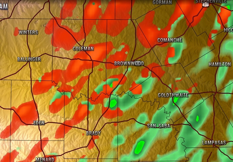
“I’m also expecting precipitation to start early Friday morning, initially light rain, but temperatures cold enough that light sleet or snow could mix in through Friday morning into early afternoon. As of now, I don’t anticipate significant accumulations or widespread travel issues, but keep an eye on bridges and overpasses for icy slick spots Friday morning,” Turner said.

IN THE PHOTO: (A high resolution computer model suggesting a mixture of light rain (green) and sleet (red) over the Brownwood/Central Texas area as of 9:00 am Friday.)
The low is forecast to be 30-32 degrees by early Friday morning. The high Friday is forecast to be 34-36 in the Brown County/Central Texas area.
The coldest night is Friday night when the temperature is forecast to drop to near 20 before warming to the middle 50’s Saturday under sunny skies and the middle 60’s under sunny skies on Sunday.