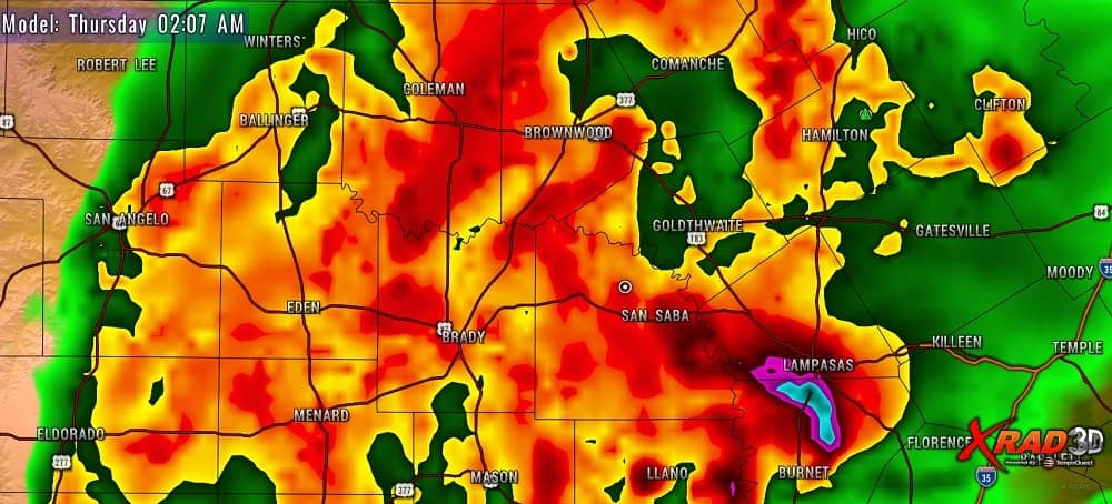
A lone thunderstorm dropped heavy rain and hail in Brady, Richland Springs and Goldthwaite Wednesday afternoon, but more storms are coming tonight.
According to KOXE Meteorologist Randy Turner, forecast model guidance indicates that storms will continue to develop this evening near the Brownwood/Early area then continue through the overnight hours. Some storms may become severe and produce some very heavy rain. A severe storm dumped pea to dime size hail on the south side of Brownwood between 6:30 and 7:00 pm.
“Models are continuing to indicate that a cold front and upper level disturbance will cause thunderstorms to fire up well before midnight and stick around until early on Thursday morning. Have a way to receive weather warnings which may be issued while you sleep tonight,” Turner said.
KOXE plans to broadcast storm coverage overnight on both radio and on the KOXE.com website and App along with their Facebook pages.
“The main threats are damaging wind and large hail but I can’t rule out tornadoes. We saw tornado warnings issued on the storm late Wednesday afternoon in Mills and Hamilton County. There is also a potential for flash flooding tonight,” Turner said.
(The photo which accompanies this story is a snap shot of the KOXE weather computer model projecting the rain as it may appear at 2:00 am Thursday morning.)